Get Directions
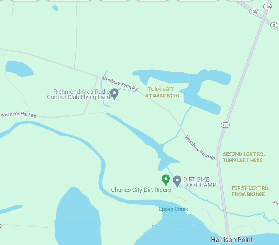
Our flying field is located in Charles City County, VA—just 30 minutes southeast of downtown Richmond, right near historic Shirley Plantation.
Driving Directions
- Address / Access: Located on Westbury Farm Rd, Charles City, VA 23030.
- From Downtown Richmond: Take I-64 E heading southeast toward Charles City for about 30 minutes. Turn onto Westbury Farm Rd near the entrance to Shirley Plantation. It is the dirt road just before the white fence.
- From I-295: Take Exit 22A for VA-5 E (John Tyler Memorial Hwy) and continue east for roughly 15 miles. Turn right on Rt 156 (Roxbury Rd), go approximately 1 mile and turn right on dirt road (Westbury Farm Rd.) at the white fence.
Flying Field Details & Amenities
On-Site Amenities: Covered pit area, assembly tables, and spectator seating.
Airspace: Expansive, clear rural airspace directly adjacent to the James River corridor.
Runway: Well-maintained grass runway configured for smooth takeoffs and landings.
Flight Line Layout: Centered flight stands with optimized spacing to ensure clear voice callouts and maximum safety between pilots.
The field is near Shirley Plantation in Charles City County, southeast of Richmond.
The final approach uses Westbury Farm Rd (unpaved road.) Coordinates 37.336258 LAT -77.237004 LON