Get Directions
Our flying field is located in Charles City County, VA—just 30 minutes southeast of downtown Richmond, right near historic Shirley Plantation.
Driving Directions
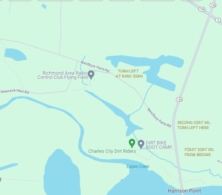
Our Club is Located on Westbury Farm Rd in Charles City, VA near Shirley Plantation
GPS Coordinates: 37.336438, -77.236972
Google Maps Link: https://maps.app.goo.gl/shxLV27aMk2wcCa18
From Interstate I-64: (64 Eastbound from Richmond / 64 Westbound from Hampton Roads)
Take exit 211 from I-64. At the end of the ramp go South on VA-106 S / VA-609 S towards Roxbury / Prince George for 15 miles
Turn Right onto Westbury Farm Rd / Weaneck Haul Rd (Look for the gravel road next to a white fence and Shirley Plantation sign,
approx.1 mile past the flashing yellow light at Rt 5. Our field will be on the left just over ½ mile on the gravel road
From Interstate I-295: (I-295 South from Richmond / I-295 North from Petersburg/Hopewell)
Take exit 22A to onto VA-5 East (John Tyler Memorial Hwy) toward Charles City for 11 miles
Turn right at the flashing yellow light at Rt 106 going towards Prince George / Benjamin Harrison Bridge
Turn Right onto Westbury Farm Rd / Weaneck Haul Rd (Look for the gravel road next to a white fence and
Shirley Plantation sign, approx.1 mile. Our field will be on the left just over ½ mile on the gravel road
From Rt 10 in Prince George County:
Go North on Rt 106 towards the Benjamin Harrison Bridge / Jordan Point Marina
After crossing the bridge in a ½ mile turn left onto Westbury Farm Rd / Weaneck Haul Rd (Look for the gravel road next to a white fence and Shirley Plantation sign
Our field will be on the left just over ½ mile on the gravel road.
Flying Field Details & Amenities
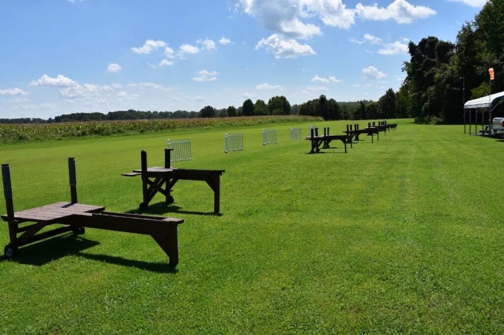
On-Site Amenities: Covered pit area, assembly tables, and spectator seating.
Airspace: Expansive, clear rural airspace directly adjacent to the James River corridor.
Runway: Well-maintained grass runway configured for smooth takeoffs and landings.
Flight Line Layout: Centered flight stands with optimized spacing to ensure clear voice callouts and maximum safety between pilots.
The field is near Shirley Plantation in Charles City County, southeast of Richmond.
The final approach uses Westbury Farm Rd (unpaved road.) Coordinates 37.336438 LAT -77.236972 LON